Investigating the accuracy of plant traits measured using drones (UA318)
START
July 1, 2018
FINISH
June 30, 2019

Tags: assessment | data | drone | field trial | height | Mallala | plant growth | Roseworthy | vegetation | wheat
Summary
This project expanded on the work of SAGIT project UA217 conducted in 2017 to assess the viability of using images from drones to measure wheat height and biomass in trial plots.
Red/green/blue (RGB) images from drones at multiple time points across the growing season were used to calculate plant height and biomass in field trial plots to non-destructively measure and quantify the growth rates of different wheat varieties. Differences in crop growth rates was detected among 16 different wheat. However, accuracy was reduced in a dry growing season.
Background
Research from a previous SAGIT-funded project (UA217) found RGB imagery from drones can be used to non-destructively and accurately assess the height and biomass of wheat in trials at individual time-points throughout the growing season. It also suggests there may be value in using drones to non-destructively measure biomass across the growing season to estimate shoot growth rates of different wheat varieties.
Current methods for assessing these factors are often destructive (such as quadrat cuts), which influences grain yield results.
Research Aims
The core objectives of the project were to:
- Refine methods to accurately quantify plot biomass greenness and to measure the growth rates of bread wheat varieties using non-destructive aerial imaging.
- Use aerial imaging to phenotype field trial plots to assist with the identification of plant traits linked to higher grain yields at sodic sites.
In The Field
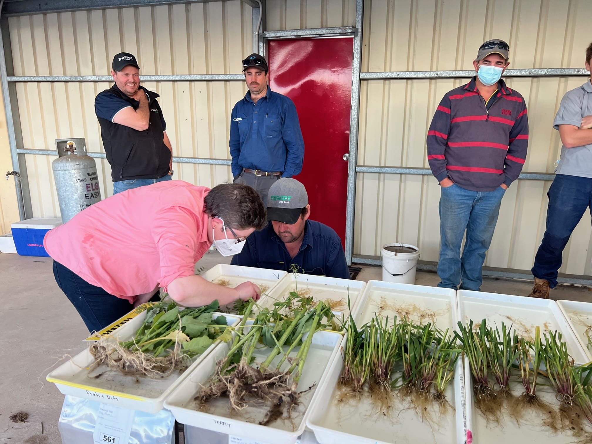
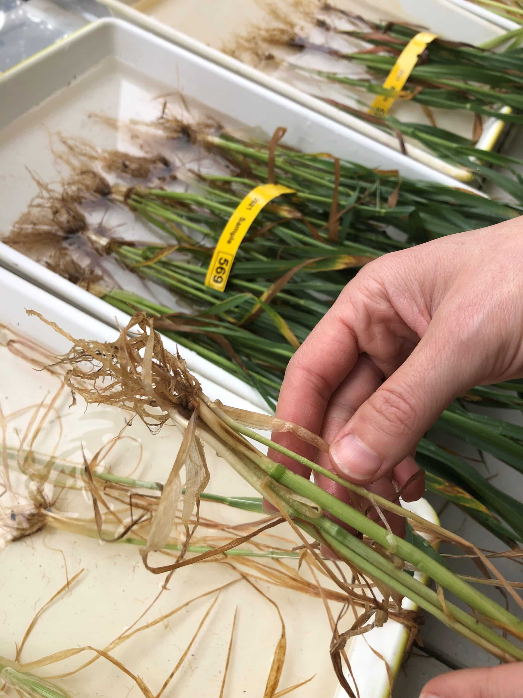
In 2018, a drone (DJI Phantom 4 Pro quadcopter) with an RGB camera was used to take aerial imagery of field trials of 16 bread wheat varieties at Mallala and Roseworthy. Images were taken at multiple times in the growing season at early tillering, stem elongation, booting, anthesis and grain filling. The Roseworthy site was also imaged with a multispectral and thermal camera at grain filling.
These were compared to ground measurements by measuring plant height with a ruler and using destructive biomass quadrat cuts. The RGB images were used to calculate canopy height and biomass for each plot at each time-point to quantify crop growth rates of individual wheat varieties.
This project expanded on the work of SAGIT project UA217 conducted in 2017 to assess the viability of using images from drones to measure wheat height and biomass in trial plots.
Red/green/blue (RGB) images from drones at multiple time points across the growing season were used to calculate plant height and biomass in field trial plots to non-destructively measure and quantify the growth rates of different wheat varieties. Differences in crop growth rates was detected among 16 different wheat. However, accuracy was reduced in a dry growing season.
The trial plots assessed were part of a GRDC-funded project (UA00159) investigating the development of wheat with tolerance to sodic soils.
Results
Plant height and biomass of bread wheat in field trial plots can be quantitively measured using RGB images taken from drones.
Growth rates and plant biomass of different wheat varieties can be measured during the growing season in a non-destructive manner using RGB images from drones.
Variation in canopy growth rates was detected among different wheat varieties, indicating pre-breeding and breeding trials could use RGB images from drones for high-throughput screening of wheat lines across different environments.
Biomass and height values from RGB images were less accurate in a dry growing season. This is likely due to there being less variation in height and biomass between the varieties and ground measurements being a poor representation of the entire plot.
Project Participants
University of Adelaide: Dr Rhiannon Schilling, A/Prof Glenn McDonald, Dr Ramesh Raja Seragan, Dillon Campbell, Lucy Cunningham.
The Problem
Plot measurements of wheat growth in field trials are often destructive and impact final yield results.
The research
Assesses the ability of drones with RGB cameras to gather accurate data on crop growth.
More information
Dr Rhiannon Schilling, SARDI
T: 08 8429 2926
M: 0407 815 199
E: [email protected]


Value for Growers
The trial has shown RGB aerial imagery taken with drones is valuable in non-destructively monitoring the shoot biomass of different wheat varieties in field trial plots. It also assisted in developing protocols on how to use RGB images from drones collected across the growing season to assess crop growth rates.
This method to measure crop growth rates will help to fast track the screening of pre-breeding and breeding wheat lines under different environments (such as sodic soils), and thus, help to identify the most promising wheat lines to be used to develop new elite wheat varieties for South Australian growers.
The project is also of direct value to growers as it showcased the growing number of technological options available for growers to assess their crops in field, in particular how an RGB camera on a drone can offer widescale information on wheat crop biomass and growth.
Latest Research Projects